

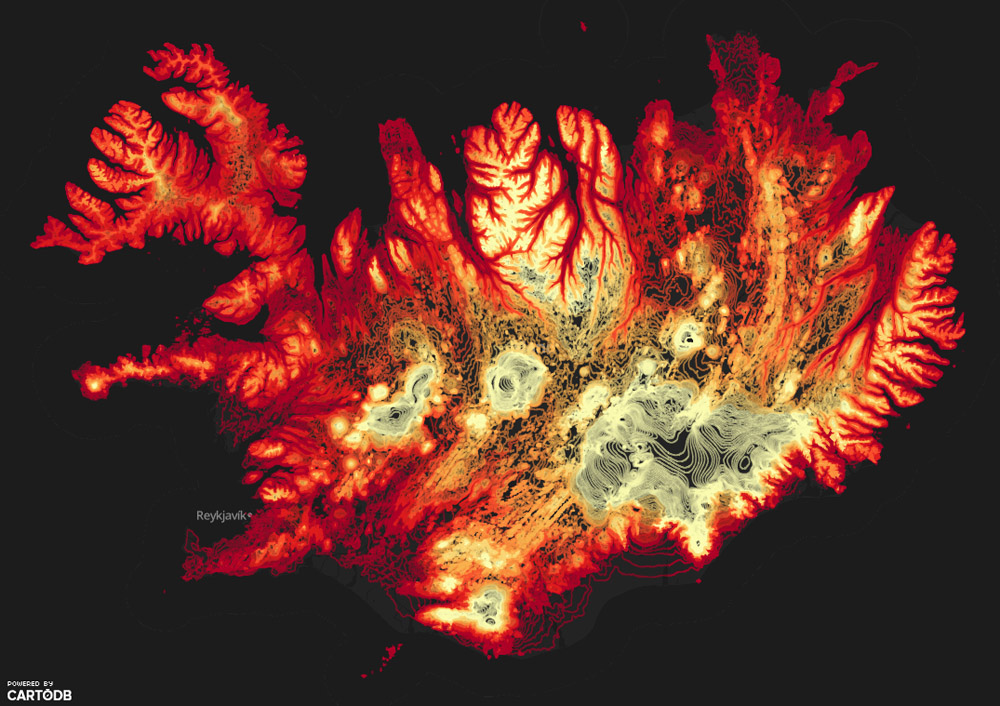


“Here’s why Iceland is one of the most amazing places on Earth,” WIRED author Betsy Mason writes, “It is the only spot where a mid-ocean ridge can be seen above water.” With both active volcanoes and cool blue glaciers, Iceland’s topography is truly intriguing. The map featured in this WIRED article, originally published on CartoDB, is a visual representation of Iceland’s elevation levels.
The colors chosen for this map are striking, with bright yellow representing the highest peaks and dark red representing the lowest points. Iceland’s dramatic elevation changes are a result of of its location on a mid-ocean ridge, which is essentially a “continuous line of major volcanic activity.”
Mason, the author of the WIRED article, later discovered that this map was created for use in another project. Iceland’s Aitor Garcia Rey gathered this topographic data in order to create a toponotebook of Iceland’s Eyjafjallajokull volcano. Rey plans to create different series of notebooks featuring interesting landforms from around the world.
To learn more about this map and about Altor Garcia Rey’s toponotebooks, read the full WIRED article here.
Comments
article Next
article